Assam has a rich cultural heritage going back to the
Ahom Kingdom which governed the region for many centuries before the British occupation. Other notable features include the
Brahmaputra River, the mystery of the bird suicides in
Jatinga, numerous temples including
Kamakhya of
Tantric sect, ruins of palaces, etc.
Guwahati, the capital city of Assam, boasts many bazaars, temples, and wildlife sanctuaries.
Kaziranga National Park
Kaziranga is a vast expanse of tall
elephant grass,
marshland, and dense
tropical moist broadleaf forests, crisscrossed by four major rivers, including the
Brahmaputra, and the park includes numerous
small bodies of water. Kaziranga has been the theme of several books, songs, and documentaries. The park celebrated its centennial in 2005 after its establishment in 1905 as a
reserve forest.
History:
The history of Kaziranga as a protected area can be traced back to 1904, when
Mary Victoria Leiter Curzon, the wife of the
Viceroy of India,
Lord Curzon, visited the area.
[citation needed] After failing to see a single rhinoceros, for which the area was renowned, she persuaded her husband to take urgent measures to protect the dwindling species which he did by initiating planning for a their protection
] On 1 June 1905, the Kaziranga Proposed Reserve Forest was created with an area of 232 km
2 (90 sq mi).
Over the next three years, the park area was extended by 152 km
2 (59 sq mi), to the banks of the
Brahmaputra River.[not in citation given] In 1908, Kaziranga was designated a
Reserve Forest. In 1916, it was converted to a game sanctuary—
The Kaziranga Game Sanctuary—and remained so till 1938, when hunting was prohibited and visitors were permitted to enter the park.
[citation needed] The Kaziranga Game Sanctuary was renamed the Kaziranga Wildlife Sanctuary in 1950 by P. D. Stracey, the forest conservationist, in order to rid the name of hunting connotations.
[citation needed] In 1954, the government of Assam passed the Assam (Rhinoceros) Bill, which imposed heavy penalties for rhinoceros poaching.
[citation needed] Fourteen years later, in 1968, the state government passed 'The Assam National Park Act of 1968', declaring Kaziranga a designated national park.
[citation needed] The 430 km
2 (166 sq mi) park was given official status by the central government on 11 February 1974. In 1985, Kaziranga was declared a
World Heritage Site by
UNESCO for its unique natural environment.
Kaziranga has witnessed several natural and human-made calamities in recent decades. Floods caused by overflowing of river Brahmaputra have led to significant losses of animal life. Encroachment by humans along the periphery also has led to a diminished forest cover and a loss of habitat.
[citation needed] An ongoing separatist movement in Assam by the
United Liberation Front of Asom (ULFA) has crippled the economy of the region, but Kaziranga has remained unaffected by the movement—in fact—instances of rebels from the United Liberation Front of Assam protecting the animals and, in extreme cases killing poachers, have been reported since the 1980s.
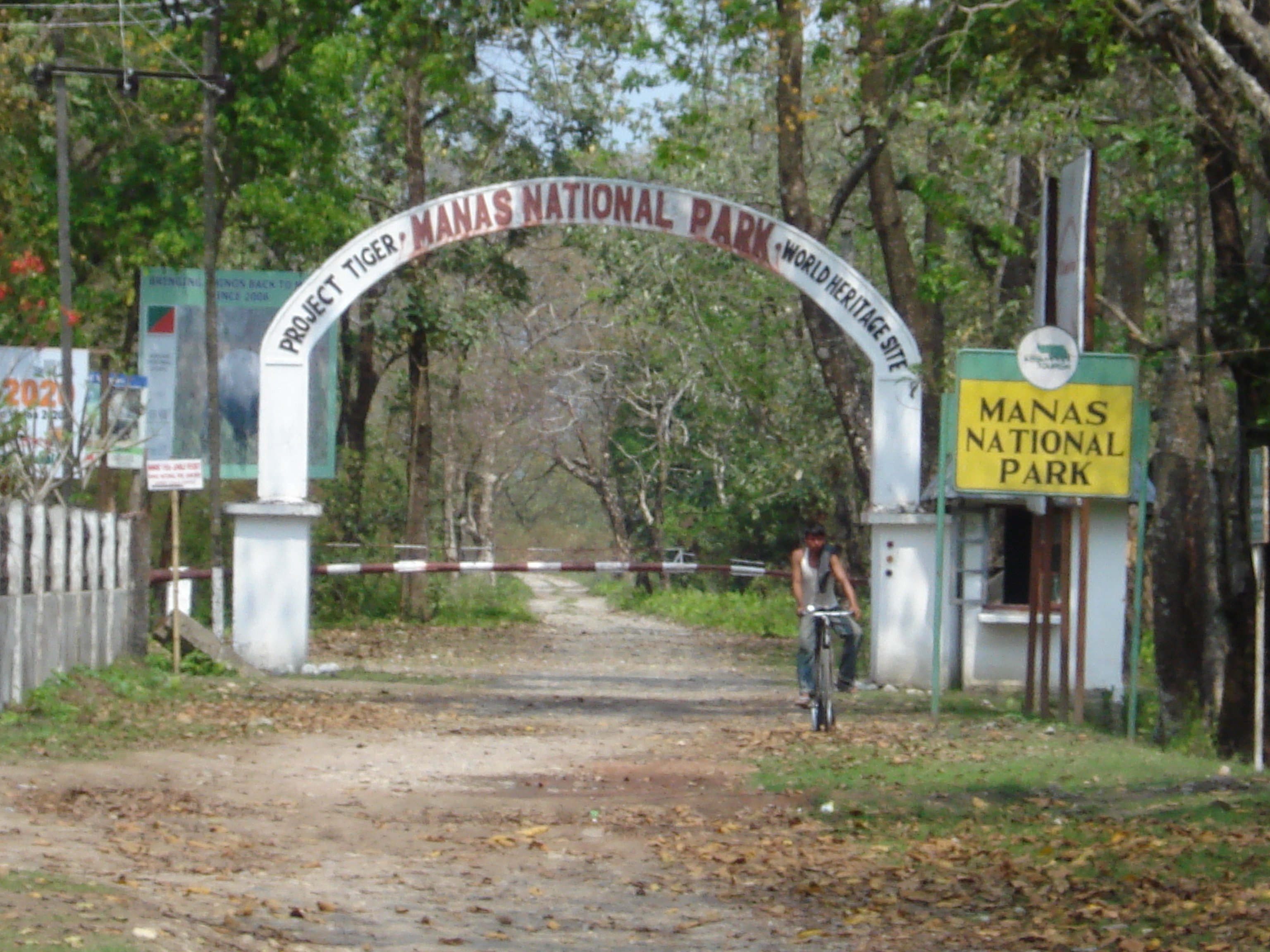
The park celebrated its centenary with much fanfare in 2005, inviting descendants of Baroness and Lord Curzon for the celebrations. In early 2007, elephants and two rhinoceros were relocated to
Manas National Park, the first instance of relocation of elephants between national parks in
India.
Geography:
The park is approximately 40 km (25 mi) in length from east to west, and 13 km (8 mi) in breadth from north to south. Kaziranga covers an area of 378 km
2 (146 sq mi), with approximately 51.14 km
2 (20 sq mi) lost to erosion in recent years. A total addition of 429 km
2 (166 sq mi) along the present boundary of the park has been made and designated with separate national park status to provide extended habitat for increasing the population of wildlife or, as a corridor for safe movement of animals to Karbi Anglong Hills. Elevation ranges from 40 m (131 ft) to 80 m (262 ft).
[citation needed] The park area is circumscribed by the Brahmaputra River, which forms the northern and eastern boundaries, and the
Mora Diphlu, which forms the southern boundary. Other notable rivers within the park are the
Diphlu and
Mora Dhansiri.
Kaziranga has flat expanses of fertile,
alluvial soil formed by
erosion and silt deposition by the Brahmaputra.
[citation needed] The landscape consists of exposed
sandbars, riverine flood-formed lakes known as,
beels, (which make up 5% of the surface area),
[citation needed] and elevated regions known as,
chapories, which provide retreats and shelter for animals during floods. Many artificial
chapories have been built with the help of the
Indian Army to ensure the safety of the animals. Kaziranga is one of the largest tracts of protected land in the sub-Himalayan belt, and due to the presence of highly diverse and visible species, has been described as a
"biodiversity hotspot". The park is located in the
Indomalaya ecozone, and the dominant
biomes of the region are
Brahmaputra Valley semi-evergreen forests of the
tropical and subtropical moist broadleaf forests biome and a frequently flooded variant of the
Terai-Duar savanna and grasslands of the
tropical and subtropical grasslands, savannas, and shrublands biome.
Transport:
Authorised guides of the forest department accompany all travellers inside the park.
Mahout-guided elephant rides and
Jeep or other
4WD vehicles rides are booked in advance. Starting from the Park Administrative Centre at
Kohora, these rides can follow the three motorable trails under the jurisdiction of three ranges—Kohora, Bagori, and Agaratoli. These trails are open for light vehicles from November to mid-May. Visitors are allowed to take their own vehicles when accompanied by guides.
[citation needed]
Fauna:
Kaziranga contains significant breeding populations of 35 mammalian species, of which 15 are threatened as per the IUCN Red List. The park has the distinction of being home to the world's largest population of the Great Indian One-Horned Rhinoceros (1,855), Wild Asiatic Water Buffalo (1,666) and Eastern Swamp Deer (468). Significant populations of large herbivores include elephants (1,940), gaur (30) and sambar (58). Small herbivores include the Indian Muntjac, wild boar, and hog deer. 
Kaziranga is one of the few wild breeding areas outside Africa for multiple species of large cats, such as Indian Tigers and Leopards. Kaziranga was declared a Tiger Reserve in 2006 and has the highest density of tigers in the world (one per five km²), with a population of 86, as per the 2000 census.[20] Other felids include the Jungle Cat, Fishing Cat, and Leopard Cats. Small mammals include the rare Hispid Hare, Indian Gray Mongoose, Small Indian Mongooses, Large Indian Civet, Small Indian Civets, Bengal Fox, Golden Jackal, Sloth Bear, Chinese Pangolin, Indian Pangolins, Hog Badger, Chinese Ferret Badgers, and Particolored flying squirrels. Nine of the 14 primate species found in India occur in the park. Prominent among them are the Assamese Macaque, Capped, Golden Langur, as well as the only ape found in India, the Hoolock Gibbon.[6][19][citation needed] Kaziranga's rivers are also home to the endangered Ganges Dolphin. Kaziranga has been identified by Birdlife International as an Important Bird Area. It is home to a variety of migratory birds, water birds, predators, scavengers, and game birds. Birds such as the Lesser White-fronted Goose, Ferruginous Duck, Baer's Pochard duck and Lesser Adjutant, Greater Adjutant, Black-necked Stork, and Asian Openbill stork migrate from Central Asia to the park during winter. Riverine birds include the Blyth's Kingfisher, White-bellied Heron, Dalmatian Pelican, Spot-billed Pelican, Spotted Greenshank, and Black-bellied Tern.[26]:p.10 Birds of prey include the rare Eastern Imperial, Greater Spotted, White-tailed, Pallas's Fish Eagle, Grey-headed Fish Eagle, and the Lesser Kestrel. Kaziranga was once home to seven species of
vultures, but the vulture population reached near extinction, supposedly by feeding on animal carcasses containing the drug
Diclofenac. Only the
Indian Vulture,
Slender-billed Vulture, and
Indian White-rumped Vulture have survived. Game birds include the
Swamp Francolin,
Bengal Florican, and
Pale-capped Pigeon.
Other families of birds inhabiting Kaziranga include the
Great Indian Hornbill and
Wreathed Hornbill,
Old World babblers such as
Jerdon’s and
Marsh Babblers,
weaver birds such as the common
Baya Weaver, threatened
Finn's Weavers,
thrushes such as
Hodgson's Bushchat and
Old World warblers such as the
Bristled Grassbird. Other threatened species include the
Black-breasted Parrotbill and the
Rufous-vented Prinia.
Two of the largest snakes in the world, the
Reticulated Python and
Rock Python, as well as the longest venomous snake in the world, the
King Cobra, inhabit the park. Other snakes found here include the
Indian Cobra,
Monocled Cobra,
Russell's Viper, and the
Common Krait.
Monitor lizard species found in the park include the
Bengal monitor and the
Water Monitor. Other reptiles include fifteen species of
turtle, such as the
endemic Assam Roofed Turtle and one species of tortoise, the
Brown Tortoise. 42 species of fish are found in the area, including the
Tetraodon.
List of mammals (incomplete):
- Great Indian One Horned Rhinoceros (Rhinoceros unicornis)
- Wild Asian Water Buffalo (Bubalus bubalis)
- Indian Elephant (Elephas maximus)
- Royal Bengal Tiger (Panthera tigris)
- Indian Wild Boar (Sus scrofa)
- Eastern Mole (Talpa micrura)
- Pangolin (Manis crassicaudata)
- Indian Gaur (Bos gaurus)
- Swamp Deer (Cervus duvauceli)
- Sambar (Cervus unicolor)
- Barking Deer (Muntiacus muntjak)
- Hoolock (Hylobates hoolock)
- Hog Deer (Axis porcinus)
- Capped Langur or Leaf Monkey (Presbytis pileatus)
- Rhesus Macaque (Macaca mulatto)
- Assamese Macaque (Macaca assamensis)
- Leopard (Panthera pardus)
- Sloth Bear(Melursus ursinus)
- Indian Porcupine (Hystrix indica)
- Fishing Cat (Felis viverrina)
- Jungle Cat (Felis chaus)
- Large Indian Civet (Viverra zibetha)
- Small Indian Civet (Viverricula indica)
- Indian Gray Mongoose (Herpestes edwardsi)
- Small Indian Mongoose (Herpestus auropunctatus)
- Bengal Fox (Vulpes bengalensis)
- Golden Jackal (Canis aureus)
- Common Otter (Lutra lutra)
- Chinese Ferret Badger (Melogale moschata)
- Hog Badger(Arctonyx collaris)
- Ganges and Indus River Dolphin (Platanista gangetica)
- Orange-bellied Himalayan Squirrel (Dremomys lokriah)
- Asiatic Black Bear (Selenarctos thibetanus)
- Bat Various Species
Flora:
There is a difference in altitude between the eastern and western areas of the park, with the western side being at a lower altitude. The western reaches of the park are dominated by grasslands. Tall elephant grass is found on higher ground, while short grasses cover the lower grounds surrounding the beels or flood-created ponds.
[citation needed] Annual flooding, grazing by herbivores, and
controlled burning maintain and fertilize the grasslands and reeds. Common tall grasses are
sugarcanes,
spear grass,
elephant grass, and the
common reed. Numerous
forbs are present along with the grasses. Amidst the grasses, providing cover and shade are scattered trees—dominant species including
kumbhi,
Indian gooseberry, the
cotton tree (in savanna woodlands), and
elephant apple (in inundated grasslands).
[citation needed] Thick evergreen forests, near the Kanchanjhuri, Panbari, and Tamulipathar blocks, contain trees such as
Aphanamixis polystachya, Talauma hodgsonii, Dillenia indica, Garcinia tinctoria, Ficus rumphii, Cinnamomum bejolghota, and species of
Syzygium. Tropical semi-evergreen forests are present near Baguri, Bimali, and Haldibari. Common trees and shrubs are
Albizia procera, Duabanga grandiflora, Lagerstroemia speciosa, Crateva unilocularis, Sterculia urens, Grewia serrulata, Mallotus philippensis, Bridelia retusa, Aphania rubra, Leea indica, and
Leea umbraculifera.
There are many different aquatic floras in the lakes and ponds, and along the river shores. The
invasive water hyacinth is very common, often choking the water bodies, but it is cleared during destructive floods.
[citation needed] Another invasive species,
Mimosa invisa, which is
toxic to herbivores, was cleared by Kaziranga staff with help from the
Wildlife Trust of India in 2005.
Visitor activities:
Observing the wildlife, including
birding, is the main visitor activity in and around the park. Guided tours by elephant or
Jeep are available.
Hiking is prohibited in the park to avoid potential human-animal conflicts.
Observation towers are situated at Sohola, Mihimukh, Kathpara, Foliamari, and Harmoti for wildlife viewing. The
Lower Himalayan peaks frame the park's landscape of trees and grass interspersed with numerous
ponds. An interpretation centre is being set up at the Bagori range of Kaziranga, to help visitors learn more about the park. The park remains closed for visitors from mid-April to mid-October due to monsoon rains. Four tourist lodges at Kohora and three tourist lodges inside the park are maintained by the
 Department of Environment and Forests, Government of Assam
. Private resorts are available outside the park borders.
:p.19 Increase in tourist inflow has led to the economic empowerment of the people living at the fringes of the park, by means of tourism related activities, encouraging a recognition of the value of its protection. A survey of tourists notes that 80 percent found rhino sightings most enjoyable and that foreign tourists were more likely to support park protection and employment opportunities financially, while local tourists favored support for veterinary services
Manash Tiger Project
The name of the park is originated from the
Manas River, which is named after the serpent goddess
Manasa. The Manas river is a major tributary of
Brahmaputra River, which passes through the heart of the national park.
History of the Park:
The Manas National Park was declared a sanctuary on October 1, 1928 with an area of 360 km². Manas Tiger reserve was created in 1973. Prior to the declaration of the sanctuary it was a Reserved Forest called Manas R.F. and North Kamrup R.F. It was used by the Cooch Behar royal family and Raja of Gauripur as a hunting reserve. In 1951 and 1955 the area was increased to 391 km². It was declared a World Heritage site in December 1985 by UNESCO. Kahitama R.F. the Kokilabari R.F. and the Panbari R.F. were added in the year 1990 to form the Manas National Park. In 1992, UNESCO declared it as a world heritage site in danger due to heavy poaching and terrorist activities. In 25 February 2008 the area was increased to 950 km².
Geography of the Park:
The park is divided into three ranges. The western range is based at Panbari, the central at
Bansbari near
Barpeta Road, and the eastern at Bhuiyapara near
Pathsala. The ranges are not well connected; while two major rivers need to be forded in going from the centre to the Panbari, there is a rough trail (the
daimAri road) connecting the central to the eastern range. Most visitors come to Bansbari and then spend some time inside the forest at Mathanguri on the Manas river at the Bhutan border.
Physical Geography: Manas is located in the
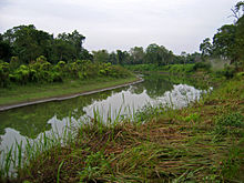
Eastern Himalaya foothills. The park is densely forested. The Manas river is the main river, a major tributary of Brahmaputra river. The Manas River flows through the west of the park, further it splits into two separate rivers, the Beki and Bholkaduba. Manas and five other small rivers flow through the National Park which lies on a wide low-lying alluvial terrace below the foothills of the outer Himalaya. The river also acts an international border diving India and Bhutan. The bedrock of the savanna area in the north of the park is made up of Limestone and sandstone, whereas the grasslands in the south of the park is made up of deep deposits of fine alluvium. The combination of Sub-Himalayan Bhabar Terai formation along with riverine succession continuing up to Sub-Himalayan mountain forest making it one of the richest biodiversity areas in the world. The park is 391 km². in area and situated at a height of 61m to 110m above mean sea level.
Climate: The minimum temperature is around 15 degree C and maximum temperature is around 37 degree C. Heavy rainfall occurs between May and September and the annual average rainfall is around 333 cm.
Biomes:
There are two major biomes present in Manas:
The grassland biome : pygmy hog, rhinoceros (re-introduced in 2007 after extinction due to heavy poaching during the Bodo uprising), bengal florican, Asiatic wild buffalo, etc.
The forest biome :
slow loris,
capped langur, wild pig, sambar, great hornbill, malayan giant squirrel or black squirrel, etc.
Flora:
Vegetation: The Burma Monsoon Forests of Manas lie on the borders between the Indo-Gangetic and Indo-Malayan biogeographical realms and is part of the Brahmaputra Valley Biogeographic Province. The combination of Sub-Himalayan Bhabar Terai formation with riverine succession leading up to Sub-Himalayan mountain forest makes it one of the richest biodiversity areas in the world.
The main vegetation types are:
Sub-Himalayan Light Alluvial Semi-Evergreen forests in the northern parts.
East Himalayan mixed Moist and Dry Deciduous forests (the most common type).
Low Alluvial Savanna Woodland, and
Assam Valley Semi-Evergreen Alluvial Grasslands which cover almost 50% of the Park.
Much of the riverine dry deciduous forest is at an early successional stage. It is replaced by moist deciduous forest away from water courses, which is succeeded by semi-evergreen climax forest in the northern part of the park. A total of 543 plants species have been recorded from the core zone. Of these, 374 species are dicotyledons (including 89 trees), 139 species monocotyledons and 30 are Pteridophytes and Gymnosperms.
The Park's common trees include
Aphanamixis polystachya,
Anthocephalus chinensis,
Syzygium cumini, S. formosum, S. oblatum,
Bauhinia purpurea,
Mallotus philippensis,
Cinnamomum tamala,
Actinodaphne obvata,
Bombax ceiba,
Sterculia villosa,
Dillenia indica, D. pentagyna,
Careya arborea,
Lagerstroemia parviflora, L.speciosa,
Terminalia bellirica, T. chebula,
Trewia polycarpa,
Gmelina arborea,
Oroxylum indicum and Bridelia spp. The Grasslands are dominated by
Imperata cylindrica,
Saccharum naranga,
Phragmites karka,
Arundo donax,
Dillenia pentagyna,
Phyllanthus emblica,
Bombax ceiba, and species of
Clerodendrum,
Leea,
Grewia,
Premna and
Mussaenda
Fauna:
The sanctuary has recorded 55 species of mammals, 380 species of birds, 50 of reptiles, and 3 species of amphibians. Out of these wildlife, 21 mammals are India’s Schedule I mammals and 31 of them are threatened.
The fauna of the sanctuary include
Asian Elephants,
Indian Rhinoceros,
Gaurs,
Asian Water Buffaloes,
Barasingha,
Tigers,
Leopards,
Clouded Leopards,
Asian golden cat,
Capped Langurs,
Golden Langurs,
Assamese Macaques,
Slow Loris,
Hoolock Gibbons,
Smooth-coated Otters,
Sloth Bears,
Barking Deer,
Hog Deer,
Sambar Deer and
Chital.
Manas houses about 380 species of birds. Manas have the largest population of endangered
Bengal Florican. The major other birds includes
Giant Hornbills,
Jungle Fowls,
Bulbuls,
Brahminy Ducks,
Kalij Pheasants,
Egrets,
Pelicans,
Fishing Eagles,
Serpent Eagles,
Falcons,
Scarlet Minivets,
Bee-Eaters,
Magpie Robins,
Pied Hornbills,
Grey Hornbills,
Mergansers,
Harriers,
Ospreys and
Herons.
Activities:
The best way to watch wildlife at the park is to use powerful binoculars, with
night vision facilities at night. A popular way to explore a majority of the Manas National Park in Assam is in a 4-wheel (Jeep) drive petrol vehicle. Much more terrain becomes available if on an elephant ride, but these are usually restricted to a few kilometers near the gate. A raft ride on Manas river from Mathanguri ending 25 km downstream at Bansbari is also a popular option. These take you deep in to the densest areas of the forest and often right in between some of the wildlife there, including elephants, rhinos and wild buffaloes. The park is open from November to April, and is closed in the remaining period owing to the
monsoon.
Lodging
Inside the park, one may stay at
Mothanguri the forest department bungalow, or at a small facility run by the
NGO Manas Ever Welfare Society (MEWS). Or one may stay at the park entrance in Bansbari, where there are two tourist lodges and also some cottages run by MEWS.

Alternately, one may stay at Kokilabari in the Eastern range (traveling in from Pathsala), where a facility is run by the
NGO MMES (Manas Maozigendri Ecotourism Society). Both the MMES and MEWS are constituted with volunteers from the fringe villages. MMES is the older group, and many of its workers were erstwhile members of the Bodo liberation struggle. The MMES camp has 4 ethnic cottages in a som plantation meant for rearing of famous muga silk of assam at the park boundary.
Approach:
- Nearest airport: Gopinath Bordoloi International Airport, Borjhar, Guwahati
- Nearest railhead: Barpeta Road
- Nearest Highway: NH 31 (22 km away)
- Nearest town: The town of Barpeta Road is next to the park boundary and entrance. The district head-quarter Barpeta is about 44 km away from the entrance.
- Nearest city: The city of Guwahati is 176 km away from the park.
Majuli
Majuli or
Majoli (Assamese: মাজুলী) is a
fluvial island in the
Brahmaputra river, in the
Indian state of
Assam. Majuli is the one of the largests riverine islands in the world and the largest freshwater island in South Asia.
Manitoulin Island in Lake Huron, Ontario, Canada is actually the largest freshwater island in the world. Majuli had a total area of 1,250 square kilometers (482.6 sq mi), but now having lost significantly to erosion it has an area of only 650 square kilometers (251.0 sq mi).

The island is formed by the
Brahmaputra river in the south and the Kherkutia Xuti, an
anabranch of the Brahmaputra, joined by the
Subansiri river in the north. The island is about 200 kilometres east from the
state's largest city —
Guwahati, and is accessible by ferries from the town of
Jorhat. The island was formed due to course changes by the river Brahmaputra and its tributaries, mainly the
Lohit. Majoli is also the abode of the
Assamese neo-Vaisnavite culture.
History:
Originally, the island was a narrow and long piece of land called Majoli (land in the middle of two parallel rivers) that had Brahmaputra flowing in the north and the Burhidihing flowing in the south, till they met at Lakhu. Frequent earthquakes in the period 1661–1696 set the stage for a catastrophic flood in 1750 that continued for 15 days, which is mentioned in historical texts and reflected in folklore. As a result of this flood, the Brahmaputra split into two anabranches—one flowing along the original channel and the other flowing along the Burhidihing channel and the Majuli island was formed. The Burhidihing's point of confluence moved 190 km east and the southern channel which was the Burhidihing became the Burhi Xuti. The northern channel, which was previously the Brahmaputra, became the Luit Xuti. In due course, the flow in the Luit Xuti decreased, and it came to be known as the Kherkutia Xuti; and the Burhi Xuti expanded via erosion to become the main Brahmaputra river.
Krishna, the popular
Hindu god is supposed to have played here with his friends. While this is speculative, the locals speak in the Assamese language. However, what is certain is Majuli has been the cultural capital of Assamese civilisation since the 16th century; based on written records describing the visit of
Sankardeva — a 16th century social reformer. Sankardeva, a pioneer of the medieval-age neo-vaishnavite movement, preached a monotheist form of
Hinduism called as
Vaishnavism and established monasteries and hermitages known as
satras on the islet.
The island soon became the leading centre of Vaishavinism with the establishment of these satras. After the arrival of the
British, the island was under the rule of the British till
India gained independence in 1947.
Economy:
The main industry is
agriculture, with
paddy being the chief crop. Majuli has a rich and diverse agricultural tradition, with as many as a hundred different varieties of
rice grown, all grown without
pesticides or artificial
fertilisers. Among the fascinating arrays of rice produced are the
Komal Saul, a unique type of rice that can be eaten just after immersing the grains in warm water for fifteen minutes, and usually eaten as a breakfast cereal; the
bao dhan, that grows under water, and is harvested after ten months and the
Bora saul, a sticky brown rice used to make the traditional cake known as
pitha,.
Fishing,
dairying,
pottery,
handloom and boat-making are other important economic activities.
Handloom is a major occupation among the distaff population of the villages. Although largely a non-commercial occupation, it keeps many of the inhabitants occupied. Weaving is exquisite and intricate with the use of a variety of colours and textures of
cotton and
silk, especially 'muga' silk..
Culture:

Majuli has been the cultural capital and the cradle of Assamese civilization for the past five hundred years. The satras set up preserve antiques like weapons, utensils, jewellery and other items of cultural significance. Pottery is made in Majuli from beaten clay and burnt in driftwood fired kilns in the same mode carried out by the peoples of the ancient
Harrappan Civilisation. Sociologists have stressed on the preservation of these unique peoples, whose culture and dance forms are untouched by
modernism. The handloom work of these tribes is also internationally famous. Virtually every single person on the island is involved in the three-day long raas festival, depicting the life of Krishna. People from hundreds of kilometres away come to celebrate this festival including a number of expatriate members of community. The satras have also honed certain art and craft traditions, which can now be found only here. In Natun Samuguri satra for example, one can still find the craft of mask-making; and in the Kamalabari satra the finest boats are made.
Neo-Vaishnavite satras
The island has been the hub of Assamese neo-
Vaishnavite culture, initiated around 15th century by the revered Assamese saint
Srimanta Sankardeva and his disciple Madhabdeva. Many
Xatras or monasteries constructed by the saint still survive and represent the colourful Assamese culture. The saint took refuge in Majuli and spent a couple of months at Beloguri in West Majuli, which was a place of grandeur for the historic and auspicious, 'Manikanchan Sanjog' between Shankardeva and Madhavdeva, this was the first
satra in Majuli. After the "Manikanchan Sanjog", sixty five satras were set up. However, today only twenty-two of the original sixty-five still survive. Sixty-five out of the six hundred and sixty-five original
satras in Assam were situated in Majuli.
The main surviving Xatras (Satra) are:
Dakhinpat Xatra : Founded by Banamalidev, a supporter of Raasleela, which is now observed as one of the National Festivals of Assam.
Garamurh Xatra : This "Satra" was founded by Lakshmikantadeva. During the end of autumn, the traditional the Raasleela is enacted with pomp and celebrations. Ancient weapons called "Bartop" or
cannonss are preserved here.
 Auniati Xatra
: Founded by
Niranjan Pathakdeva, the satra is famous for the "Paalnaam" and
Apsara Dances and also its extensive assortment of ancient Assamese artefacts, utensils,
jewellery and
handicrafts. It also has a hundred and twenty five disciples and over seven hundred thousand followers worldwide.
Kamalabari Xatra: The Kamalabari Satra, founded by Bedulapadma Ata, is a centre of art, cultural, literature and classical studies on the island. Its branch the
Uttar Kamalabari Satra has performed cultural programmes of the
Satria Art all around the country and abroad.
Benegenaati Xatra: It is a reliquary of antiques of cultural importance and an advance centre of performing art. Muraridev, the grandson of Sankaradeva's stepmother was the founder of the Satra. The royal raiment belongs to the Ahom king Swargadeo Godadhar Singha, is made of gold. Also preserved is the royal umbrella made in gold.
Shamaguri Xatra: The satra is famous for the masks making in India.

These satras are also the treasure house of "Bongeet" Matiakhara, satriya dances (Jumora Dance, Chali Dance, Notua Dance, Nande Vringee, Sutradhar, Ozapali, Apsara Dance, Satria Krishna Dance and Dasavater Dance), all promulgated by
Srimanta Sankardeva. It has also become a center for
shuddhi in the Northeast of India, due to the efforts of
Pitambar Deva Goswami.
Ecosystem:
A
wetland, Majuli is a hotspot for flora and fauna, harbouring many rare and endangered avifauna species including migratory birds that arrive in the winter season. Among the birds seen here are: the
Greater Adjutant Stork ,
Pelican,
Siberian Crane and the
Whistling Teal. After dark wild
geese and
ducks fly in flocks to distant destinations. The island is almost
pollution free owing to the lack of polluting industries and factories and also the chronic rainfall.

The island is under threat due to the extensive
soil erosion on its banks. The reason for this magnitude in erosion is the large embankments built in neighbouring towns upriver to prevent erosion there during the
monsoon season when the river distends its banks. The upshot is a backlash of the tempestuous Brahmaputra's fury on the islet, eroding most of the area. According to reports, in 1853, the total area of Majuli was 1,150 km² and about 33% of this landmass has been eroded in the latter half of 20th century. Since 1991, over 35 villages have been washed away. Surveys show that in 15–20 years from now, Majuli would cease to exist.
To save the island, the Union Government of India has sanctioned Rs 250
crores (US $ 55 million) for the protection of the isle. A petition has been sent to the
UNESCO for the declaration of Majuli to be a world natural heritage site and furthermore make it a world cultural heritage site.
Majuli is situated at a distance of 20 km from
Jorhat. One can take the bus or a hired taxi to the Nimati Steamer Ghat from where ferry services ply. The distance takes over three hours to cover, with three bus rides and two ferry rides.
On the north-bank is the river Subansiri and on the South bank, the mighty
Brahmaputra has excided the island from the main land.
Lakhimpur town is to the North and
Golaghat is to its southwest. The town of
Sibsagar is on the southeast and
Jorhat is to the south. On the extreme east is
Dibrugarh District.
The Vaishnava Satras founded by Sankardeva
The colourful culture of the tribes
Migratory birds
The Ali-ai-ligang festival in Feb-March
Pottery making
Mask making
Paal Namm festival in the end of winter
The sunset in winter
Exotic homespun masks crafts
People:
The dwellers of Majuli are mostly tribal folk. These tribal are the
mishing tribes from
Arunachal Pradesh and who immigrated here centuries ago. Apart from them, the inhabitants are also from the Deori and Sonowal Kacharis tribes. Languages spoken here are
Assamese,
Mishing, Deori. The island has
one hundred and forty four villages with a population of 150,000 and a density of 300 individuals per square km. The only mode of association to the outside world is through a ferry service which operates only twice a day. Despite inherent drawbacks faced, modernism has touched this island, with the setting up of medical centres and educational institutions. Housing too, has segued from traditional bamboo and mud construction to ones made of concrete.
The heart of all villages is the
Namghar, where villagers episodically gather to sing and pray. It is the most important public place for the villagers. After the rituals are complete, villagers decide here on issues concerning the village such as auctioning of fishing rights, what to do with money raised, and other topics of significance to the community as a whole.
The inhabitants are expert navigators by boat; their expertise is most visible during the monsoon season when they navigate the turbulent waters of the Brahmaputra. Extremism is also a major concern in the region. The insurgent group the
ULFA, has a wide network in the region and was responsible for the execution of social worker
Sanjoy Ghosh who was trying to uplift the people of the island.
Sibsagar
Sivasagar is a city in the
Sibsagar district in the state of
Assam in
India. It is the district headquarters of the Sivasagar district. Sivasagar is a heritage place in Assam famous for the monuments of Ahom kingdom. Now it is a multi-cultural city.
As of 2001 India
census, Sibsagar had a population of 54,482. Males constitute 56% of the population and females 44%. Sivasagar has an average literacy rate of 81%, higher than the national average of 59.5%: male literacy is 83%, and female literacy is 79%. In Sibsagar, 10% of the population is under 6 years of age.
Sibsagar, ex
Rangpur, was once the capital of the Ahom rulers who dominated Assam for more than 600 years. They ruled Assam virtually uninterrupted for 6 centuries until their kingdom fell to the Burmese in 1819, and their ruling class was all but wiped out. The province was liberated by the British in 1825 but, owing to the state of anarchy which prevailed in the province, it was completely annexed in 1826.
This city's main feature is the water body from which it gets its name. This is a 257-acre (1.04 km
2) tank also called Borpukhuri, at a higher elevation than the rest of the town, with three temples("Dol"s in
Assamese) on its banks. Of these temples, the most prominent is the
Sivadol, standing tall at 104 feet (32 m), drawing large crowds on
Shiv Ratri. The other temples are the Vishnudol and Devidol. The temples were built by Queen Ambika, wife of Swargadeo
Siba Singha, in the year 1734.
Attractions:
1.Rang Ghar:
Rang Ghar is a two-storied building, which was the royal sports-pavilion from which the Ahom kings and nobles witnessed games like buffalo fights and other sports at the Rupahi Pathar (pathar meaning field in Assamese) specially during Rangali Bihu festival in the Ahom capital, Rangpur. On the roof of the Rang Ghar is a design of an Ahom royal long boat. The building was constructed during the reign of Swargadeo Pramatta Singha in 1746. It is located north east to the Talatal Ghar a multi-storied royal complex in Joysagar west of Sivasagar town, on the other side of the Assam Trunk (AT) Road in Sibsagar district in Assam,India .
The Rang Ghar is said to be the oldest amphitheater in Asia. The base of the monument has a series of arched entrances and atop the roof is a decorative pair of carved stone crocodiles. In many of these, only the brick framework exists with vestiges of sculptural adornments here and there. The Ahoms, who used special thin baked bricks, did not have the use of cement and, therefore, used a paste of rice and eggs as mortar for their construction.
The Rang Ghar was the logo of the recently concluded 33rd National Games that was held from 9 to 18 February, 2007 in
Guwahati,
Assam.
2. Talatal Ghar:
Talatal Ghar or the
Kareng Ghar (meaning the royal palace in Assamese) is located in
Rangpur, one of the erstwhile capitals of the
Ahom kingdom. This capital was first established by the Swargadeo
Rudra Singha in 1707. It is located in the western part of the
Sibsagar town.
The multi-storied palace, Talatal Ghar, was built by Swargadeo Rajeswar Singha.
Rajeswar Singha added three underground stories known as Talatal Ghar made of brick and an indigenous type of cement to the four storied Kareng Ghar (or palace) built by Rudra Singha and his other sons. The Talatal Ghar had two secret underground tunnels connected to the Dikhow river and the Garhgaon Palace for use as an escape route in case of any enemy attack.

Visitors nowadays can only view the ground floor and first floor and some of remaining portion of the 2nd and 3rd floor of the palace. The underground stories have been sealed and many of the wooden structure of the palace has vanished with time. The palace was surrounded by a brick fortification and also by an earthen fort (Garh) with
dikes filled with water. There is a Khar Ghar or gun-powder and ammunition store near the palace.
3. Sivadol:

The
Sivadol (
Hindi:
शिवडोल) stands on the bank of Borpukhuri tank in the heart of
Sivasagar,
Assam. It was built in 1734 by Bar Raja Ambika, queen of
Ahom king Swargadeo
Siba Singha. The Sivadol (
dol means temple in
Assamese) is believed to be the tallest
Shiva temple in
India. Its height is 104 feet (32 m) and the perimeter is 195 ft (59 m) at the base. It is capped by an eight feet high golden-dome. Each year during the
Shivaratri, a huge
mela (fair) is organised in the temple ground and pilgrims from all over India arrives here to offer puja.
4. Namdang Stone Bridge:
The
Namdang Stone Bridge is historic bridge located a few kilometers away from
Sibsagar town in Assam, India. It was constructed in 1703 by craftmen brought from Bengal during the reign of Ahom king Rudra Singha. The bridge is 60 m long (196.85 ft), 6.5 m wide (21.32 ft) and 1.7 m high (5.57 ft). It runs over the Namdang river, a tributary of the Dikhou river. The present
National Highway 37 is passing over it. The unique characteristic of the bridge is that it was cut out from a single solid piece of rock hundred years of age
 Legends:
A new addition is the Ahom Museum on the bank of the Sibsagar. It stores artefacts of the rulers, including swords, clothes, manuscripts, goblets and platters. The ancient capital of the
Ahoms is
Gargaon about 13 km east from Sibsagar, where the major draw is the Kareng Ghar, a seven-storied palace built by 18th century architects. Charideo situated nearby, is another old capital which was built by Sukapha, the founder of the
Ahom dynasty. There are maidams or vaults for the king and members of royal families here. Travellers cross the
Namdang stone bridge, carved out of a single boulder hundreds of years ago, over which the busy national highway (NH 37) still runs today.
6. Joysagar Pukhuri:
The Joysagar lake is located in
Sibsagar town in
Assam, India. This large man made lake was built in honor of Joymoti, by her son
Ahom king Rudra Singha. The buildings housing the Sibsagar College are seen along the banks in the distance. Also visible along the horizon are the hills of neighbouring
Nagaland.
Transport:
The nearest airports are
Jorhat (55 km),
Dibrugarh (80 km) and
Guwahati (369 km). Buses ply regularly from
Jorhat,
Dibrugarh and
Guwahati. Sibsagar Town is the beautiful town & it also have a railway station. The Dibrugarh - Yesvantpur Express connects this station. The nearest railway station on the Tinsukia-Guwahati sector of North East Frontier Railways is Simaluguri, 16 km from Sibsagar town. Buses ply regularly from Simaluguri towards Sibsagar. Taxis are also available for hire from the railway station. It is approximately a half-hour bus ride from Simaluguri town.
Kamakhya Temple
Description:
The current temple structure was constructed in 1565 by
Chilarai of the
Koch dynasty in the style of medieval temples. The form of the earlier structure, destroyed by the Kala Pahar, is unknown. The current structure has a
beehive-like
shikhara with delightful sculptured panels and images of
Ganesha and other
Hindu gods and goddesses on the outside. The temple consists of three major chambers. The western chamber is large and rectangular and is not used by the general pilgrims for worship. The middle chamber is a square, with a small idol of the Goddess, a later addition. The walls of this chamber contain sculpted images of Naranarayana, related inscriptions and other gods. The middle chamber leads to the
sanctum sanctorum of the temple in the form of a cave, which consists of no image but a natural underground spring that flows through a
yoni-shaped cleft in the bedrock. During the Ambuvaci festival each summer,the menstruation of the Goddess Kamakhya is celebrated. During this time, the water in the main shrine runs red with iron oxide resembling menstrual fluid.
It is likely that this is an ancient
Khasi sacrificial site, and worshiping here still includes sacrifices. Devotees come every morning with goats to offer to
Shakti.
Worship:
The Kamakhya Temple in Assam symbolizes the "fusion of faiths and practices" of Aryan and non-Aryan elements in Assam. The different names associated with the goddess are names of local Aryan and non-Aryan goddesses (Kakati 1989, p38). The
Yogini Tantra mentions that the religion of the
Yogini Pitha is of
Kirata origin.
According to Banikanta Kakati, there existed a tradition among the priests established by Naranarayana that the
Garos, a
matrilineal people, offered worship at the Kamakhya site by sacrificing pigs (Kakati 1989, The goddess is worshiped according to both the
Vamachara (
Left-Hand Path) as well as the
Dakshinachara (
Right-Hand Path) modes of worship (Kakati, 1989 p45). Offerings to the goddess are usually flowers, but might include animal sacrifices. In general female animals are exempt from sacrifice, a rule that is relaxed during mass sacrifices
According to the
Kalika Purana, Kamakhya Temple denotes the spot where
Sati used to retire in secret to satisfy her amour with
Shiva, and it was also the place where her
yoni fell after Shiva danced with the corpse of Sati. This is not corroborated in the
Devi Bhagavata, which lists 108 places associated with Sati's body, though Kamakhya finds a mention in a supplementary list. The
Yogini Tantra, a latter work, ignores the origin of Kamakhya given in
Kalika Purana and associates Kamakhya with the goddess
Kali and emphasizes the creative symbolism of the
yoni.
Kamakhya during Ahom era:
According to a legend the
Koch Bihar royal family was banned by
Devi herself from offering puja at the temple. In fear of this curse, to this day no descendants of that family dares to even look upward towards the Kamakhya hill while passing by.
Without the support of the Koch royal family the temple faced lot of hardship. By the end of 1658, the
Ahoms under king Jayadhvaj Singha had conquered the Lower Assam and their interests in the temple grew. In the decades that followed the Ahom kings, all who were either devout
Shaivite or
Shakta continued to support the temple by rebuilding and renovating it.
Rudra Singha (reign 1696 to 1714) was a devout Hindu and as he grew older he decided to formally embrace the religion and become an orthodox Hindu by being initiated or taking sharan of a Guru, who would teach him the mantras and become his spiritual guide. But, he could not bear the thought of humbling himself in front a Brahmin who is his subject. He therefore sent envoys to
Bengal and summoned Krishnaram Bhattacharyya, a famous mahant of
Shakta sect who lived in Malipota, near Santipur in
Nadia district. The mahant was unwilling to come, but consented on being promised to be given the care of the Kamakhya temple to him. Though the king did not take sharan, he satisfied the mahant by ordering his sons and the Brahmins in his entourage to accept him as their spiritual guru.
When Rudra Singha died, his eldest son Siba Singha (reign 1714 to 1744), who became the king, gave the management of the Kamakhya temple and along with it large areas of land (Debottar land) to Mahant Krishnaram Bhattacharyya. The Mahant and his successors came to be known as Parbatiya Gosains, as they resided on top of the Nilachal hill. Many Kamakhya priests and modern Saktas of Assam are either disciples or descendants of the Parbatiya Gosains, or of the Nati and Na Gosains.
Festivals:
Being the centre for Tantra worship this temple attracts thousands of tantra devotees in an annual festival known as the
Ambubachi Mela. Another annual celebration is the
Manasha Puja.
Durga Puja is also celebrated annually at Kamakhya during
Navaratri in the autumn. This five day festival attracts several thousand visitors.
Jatinga
Jatinga , a village on a ridge, is located in the
North Cachar Hills district,
Assam State in
India. It is 330km south of
Guwahati. It is most famous for the phenomenon of birds “committing suicide”. This small place of beauty is mainly inhabited by about 2,500
Jaintia tribal people.
Bird mystery of Jatinga:
At the end of
monsoon months, mysterious behavior of birds takes place. During moonless and foggy dark nights between 6 p.m. and 9:30 p.m., flying birds come crashing to the ground with no prior warning whatsoever.
[1] The local tribals first took this natural phenomenon to be spirits flying from the sky to terrorize them. This phenomenon is not confined to a single species, with
Tiger Bittern,
Black Bittern,
Little Egret,
Pond Heron,
Indian Pitta and
Kingfishers all being affected.
The cause of it is likely to be disorientation at high altitudes and high speed winds due to the widespread fog characteristic at the time. The zoological survey of India sent famous naturalist Dr Sudhir Sengupta to unravel this mystery. Dr Sengupta is of the opinion that weather conditions make changes in the magnetic qualities of the underground water in this area. These changes disturb the physiological rhythm of the local birds and they start behaving abnormally towards the sources of light.
Speculation:
According to The Statesman, the birds are attracted to the villagers' torches and then killed upon landing. The Statesman does not explain why birds all over the planet are not also disoriented by torches and street lamps thus causing a much larger annual bird death toll.
Conservation groups and wildlife officials in
India have taken steps to prevent wanton killing of birds across India, creating awareness in the illiterate villagers. Since then, the amount of birds killed have decreased by about 40 percent.
However, there is still ongoing research into this phenomenon.
Tezpur
Tezpur is a city and the administrative headquarters and
municipal board of
Sonitpur district in the
state of
Assam in northeastern
India. Tezpur is an ancient city on the banks of the river
Brahmaputra and is the largest of the north bank towns with a population exceeding 100,000.
Tezpur is considered to be the cultural capital of Assamese culture. Being from the core
Assamese cultural region, the town has produced many stalwarts such as Dr.
Bhupen Hazarika,
Jyoti Prasad Agarwala (1903–51),
Kalaguru Bishnu Prasad Rabha (1909–69),
Phani Sarma (1909–70) and Ananda Chandra Agarwala (1874–1939). It is also the birth place of the former Speaker of the Indian Parliament (2004–2009), Somnath Chatterjee.
Attractions:
1. Agnigarh:
 Agnigarh
 is the site of the fortress which was built by
Banasura to keep his daughter
Usha in isolation. The name itself is derived from the words '
Agni' (meaning
fire) and 'garh' (meaning fortress or wall) in
Sanskrit.
Legend has it that this fortress was surrounded by fire at all times so that nobody could go in or out of the perimeter without permission.
Usha fell in love with
Aniruddha in her dreams not knowing who he was. Her companion
Chitralekha identified him by painting his portrait from Usha's description. Present day Agnigarh is a hill on the banks of the
Brahmaputra which is one of the big tourist attractions in
Tezpur. There is a circular stairway leading up to the crest of the hill where there are now sculptures depicting
Usha's abduction of
Aniruddha, the grandson of
Krishna and the ensuing battle by
Krishna to free them. There is also a viewing platform with the scenery around the river banks as well as the town centre and the
Kolia Bhomora Setu bridge across the Brahmaputra.
2. Bhairabi Temple
The
Bhairabi Temple is located on the outskirts
Tezpur in
Assam, India. The Goddess
Durga is worshipped here. The backdrop of the temple is a view looking towards the
Kolia Bhomora Setu across the
Brahmaputra River. The temple site is also locally known as
Maithan and
Bhairabi Devalaya. Legend has it that Usha (daughter of mighty Asura King
Banasura) regularly came here for the worshipping of the Goddess. About a couple of kilometres away lie the
Bamuni Hills where one can view the ruins of the palace that stood many centuries ago. The art work on stone carvings that were used within the structure are from the 9th century.The temple is now managed by the Government through the office of the District Deputy Commissioner. There are sacrificial offerings of goats and bulls that still occurs regularly here. The entrance to the temple is through a very long staircase that leads up from the approach road to the temple itself. There are numerous facilities for the purchase of ghee lamps,
incense sticks, sweets and fruits etc. that are offered during prayers for blessings.

- The 3.015 km long road bridge across the Brahmaputra
Ketakeshwar Dewal - Shiva shrine
Mahabhairav Temple - Shiva shrine
Padum Pukhuri - Central lake with an island in the middle
Rudrapath - Shiva shrine
Bamuni Pahar
Da Parbatia Gate of Gupta period
Hazara pukhuri- Pond of gupta period
Nag Shankar- Temple of lord Shiva
Barpeta
Barpeta is the headquarters of
Barpeta district,
Assam,
India. The city is located about 90 kilometres (56 mi) north west of
Guwahati. Barpeta is renowned in the Historical map of Assam as the "Land of the Satras". These Satras bear the testimony of the great Assamese reformer, saint, Scholar and Cultural exponent Srimanta Sankardeva and his able disciple Shri Shri Madhabdeva who arrived from Upper Assam back in the 16th century to lay down strong foundation of Assamese Culture in the region through his socio-religious Vaishnava-reform movement. This reform movement left a historic legacy. The Barpeta Satra and various other Satras scattered around the district attract devotees from every nook and corner of Assam.
Historical background:
Barpeta has been a place of great religious importance. Known by various names like Tatikuchi, Porabhita, Mathura, Vrindavan, Choukhutisthan, Nabaratna-Sabha, Icchakuchi, Pushpak Vimana, Kampur and Barpeta. It was Koch King Naranarayan who founded Barnagar (Sorbhog) The present District formed an integral part of the Koch-Hajo and the
Ahom Kingdom till British Administration took over. From the ancient period Barpeta witnessed the rule of the Varmans (380-654) the Salasthamas (655-985) the Palas (985-1260) the Kamatas (1260–1509)& the Koches from 1509. During the Kamata & Koch rule major historical development took place. During this period large number of local feudatory-chiefs who are primarily land lords called 'Bhuyans' ruled the region. Number of villages constituted a 'Chakla' placed under a Bhuyan was patronised by the Kamatas. These Bhuyans arrived from eastern part of India like Kanauj, Gauda and Bengal who in passage of time became general Assamese caste and accepted the Vaishnava faith under influence of Shrimanta Sankardeva.
Koch King Naranarayan established his temporary capital at Barnagar. Here he met Shrimanta Sankardeva and his renowned disciple and sub-sequently accepted Vaishnavism when Sankardeva was invited by the monarch to Koch-Bihar. It was during King Naranarayan's regime at Barnagar the great saint established Satra at Patbaushi to spread his Socio-religious faith. The Koch rule ended with annexation by the Mughals. The valiant Ahom fought a number of battles against the invading Mughals. Some of the well-known battles were fought at Jakhlikhana, Bhabanipur and Bhatekuchi. Ahoms were defeated and Mughals took over the Administration and systematised the entire revenue administration. Kamrupa became a Sarkar,which was divided into Parganas. Barpeta,Khetri, Bajali, Barnagar, Bahbari and Bijni became Parganas. A Gomasta was appointed to run the 'Tapa' and a number of Tapas became a Pargana. For administrative convenience the Parganas were divided into Taluks, lats and villages. Parganas were placed under Barbaruas and Choudhuries. Taluks remained under Talukdar. They were assisted by Thakurias, Patwaries,Kakati,Gaon barika etc. who kept the revenue accounts. Judges in Parganas were called Shikdar,whereas Amin and Kanango were responsible for land-survey, assessment and collection of revenue.
With the advent of Shrimanta Sankardeva, this region turned into a religious place dotted with numerous satras and in fact Barpeta town came to be called 'Boikunthapuri Dham'. As a part of providing pantronage to various religious-places irrespective of religions, the Ahom rulers provided a large number of land-grants to the Satras. Dr. Maheswar Neog in his edited work" Prasya Sasanawali" has mentioned a large number of land-grants during the region of Shiva Singha,Rajeswar Singha,Lakshmi Singha,Gaurinath Singha and Chandra Kanta Singha. Grants were made to Muslim-Darghas of Shah Madar at Baushi, Shah Fakir at Barnagar,Panch Peer at Khetri, Syed Shahnur Dewan Fakir at Bhella,where Chandra Kanta Singha granted 100 bighas la khiraj land. Grants were made to Devalaya also. These grants were made in copper-plate inscriptions which are invaluable source of history.
Widespread destruction of life and property took place when the Maans invaded from Myanmar. Even the Barpeta Satra was razed to the ground during this invasion. To restore peace British army entered Barpeta to drove-off all the invaders. With the advent of British rule Mouzadari system came into effect.In 1841 Barpeta became a Civil Sub Division and John Batlor became the first administrator. As a part of policy of exploitation,land-revenue rates were suddenly enhanced which resulted in a number of peasant unrest in between 1893-94 particularly in Bajali and Sarukhetri area. Large number of arrests were carried out to foil attempts of unrest. The Lachima up rising is one such shining example of peasant revolt against British rule. Raijor Sabha constituted during this period raised the banner of revolt.
During the struggle for independence large number of people participated and were jailed. Madan Chandra Barman and Rauta Koch were first martyrs to sacrifice their lives during Quit India Movement of 1942. Some of the important Congress leaders who led the Freedom-struggle are Umesh Chandra Brahmachari, Dhaniram Talukdar, Ganesh Lal Choudhury, Debendra Nath Uzir, Akshay Kumar Das, Bongshidhar Choudhury, Nanamohan Mazumdar, Golak Pathak, Sonaram Choudhury, Dr. Jinaram Das, Biswanath Das, Praneswar Das, Ambikagiri Raichoudhury, Mahendra Mohan Choudhury, Madhusudan Das, Upendra Chandra Das, Debendra Sharma, Naranarayan Goswami,
Kabiraj Ghanashyam Das, and Chandraprava Saikiani. Mahatma Gandhi visited Barpeta in 1934. So did
Jawaharlal Nehru in 1937.
Demographics:
As of 2001 India
census, Barpeta had a population of 41,175. Males constitute 50% of the population and females 50%. Barpeta has an average literacy rate of 80%, higher than the national average of 59.5%; with 54% of the males and 46% of females literate. 10% of the population is under 6 years of age.
Forestry:
Barpeta is the gateway to Manas National Park, one of the largest forests of Assam and one of the few tiger reserves of India. It is also famous for the various temples in the district.
Heritage & Culture:
The heritage and culture of Barpeta District is predominated by the remarkable work of the great Assamese renaissance figure and reformer Mahapurush Shrimanta Sankardeva who laid the foundation of Assamese culture and heritage in and around the district. Subsequently the great saints disciples namely Madhabdev, Haridev, Damodardev and their devotees followed the good-works of the great figure.
Geography:
Sataras:
A good number of Satras were founded by these great saints and scholars that are considered regio-cultural institutions or monasteries that had a deep impact on the Social, political, economy etc.of the region. Although the Satra institutions were established for the propagation of Vaishnavite faith but with passage of time these institutions gradually transformed into open universities to become all-embracing socio-cultural centres covering numerous subject including education, music, dance, sculpture, drama, fine-art, Ivory-works etc.
Some of the important satras are:
- Patbaushi
 Ganakkuchi
 - Jania
- Sundaridia
- Barpeta
- Baradi
- Kanara
- MOINBARI SATRA
- Garemari
- Baniyara para Bazar
Patbaushi Satra:
The Satra at Patbaushi was established by Shrimanta Sankardeva. His Vaishnava faith was spread by the guru's able disciples Shri Madhav Deva, Shri Damodar Deva and Shri Hari Deva. It was from this satra that Srimanta Sankardeva spread his faith, literature, music art-forms, culture and work-culture to its fullest form. Here the guru spent 18 years of his life with remarkable achievement including completion of the 'Kirtan Ghosa' and composition of 20 number of invaluable Borgeets. Some of the items used by these Gurus and Sachipat puthis are well-preserved here. The Satra is located about 2 km north of Barpeta town.
Ganakkuchi Satra:
This satra was founded by Sri Madhab Deva for which the land was purchased by Shrimanta Sankardeva for 1 Tola (about 10gm) Gold and nominated his close disciple Shri Madhab Deva as the satradhikar to stay here to spread his faith and he went on to stay here for 18 long years. Some of the items used by the guru and Sachipat puthis are well-preserved here. The Satra is located within the Barpeta town area.
Jania Satra:
This Satra was established by Sankardeva's disciple Shri Narayan Das Thakur Ata. He composed a large number of devotional songs here. This Satras located at a distance of 8 km from Barpeta in Barpeta Jania Road.
Sundaridiya Satra:
The Satra was established by Shri Madhab Deva after leaving Ganakkuchi Satra. The first satradhikar of Barpeta Satra Sri Mathura Das Burha Ata initially come to this Satra and became a disciple of Shri Madhab Deva. It was here that Paal Nam and Beer Nam or Thiya Nam was created by sri Madhab Deva. A large number of items used by the guru including Sachipat-puthis are preserved here.
Barpeta Satra:
Sri Madhab Deva founded the Barpeta Satra and stayed here for 8 long years. Here he appointed Sri Mathura Das Burha Ata as the first Satradhikar of the Satra. It was Burha Ata who systematised the administration of the Satra leading to development of the institution and the region of Barpeta. A democratic system was introduced which is effective till today. Large number of followers came to Barpeta & accepted the Vaishnava faith irrespective of their caste high or low that created an egalitarian Society. A new work culture developed among the followers. The Satra has several buildings. The front gate is called 'Batsora'. The main 'Kirtanghar' is where prayers or 'Nam Kirtan' are performed is an architectural splendour. Earlier built as a Kutcha house was concretised with big-pillars in 1952 with decorative wall paintings. All the 'bhakats' or 'devotees' discussed all kinds of problems in the Jagmohan Ghar. In the 'Bhajghar' a lamp is continuously burning for more than 400 years that is called 'Akhay Banti'. Sri Krishna Doul festival is organised at the premises of Doul ghar. There is a small zoo and small 'rangial' garden. Within the premises a cultural school, Keli kadam tree, Shri Shri Mathura Das Burha Ata Library, study-room, office and kitchen are also located. Constitution formulated by Sri Mathura Das Ata is still in vogue.
Baradi Satra:
This satra was also established by Sri Madhab Deva and stayed here for a very short period.Baradi Satra is the"Adi Satra" of Madhab deb.The Sankarite culture spread far and wide from Baradi making it a centre for learning. The place is located about 2 km east of Barpeta town.Holi"fakua"is one of the most holly festival of Baradi Satra.
Satra Kanara:
Established by Sri Sri Narayan Das Thakur Ata. This Satra is damaged by natural calamities. Floods creates problem for running the Satra. As a result the original inhabitants of this place shifted to Gajia and Ganakkuchi in Barpeta. The Satra is located at a distance of 16 km from Barpeta.